 |
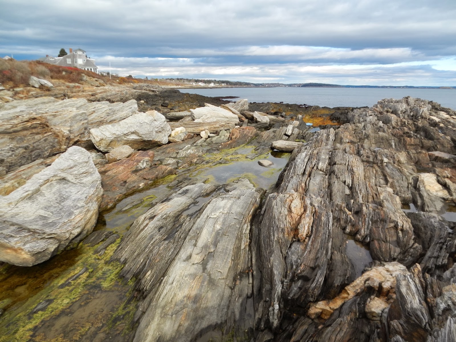
| Tidepools; note the differences in the close pools vs the far pools. Pools in the high intertidal tend to be dominated by Enteromorpha intestinalis, but in low pools, Littorina littorea preferentially eat this algae and increase diversity. |
Last week my poor students had their lab exam. This exam is stressful for them, and a ton of work for me. Setting up 13 stations with organisms involves a lot of making lists, checking them twice, and collecting a wide range of seaweeds, plants and animals from the habitats we've studied over the semester. However, it's my last hoorah for getting out in the field and enjoying the coast -- especially when the weather is halfway decent.
One of my go-to spots for not just collecting, but teaching about the rocky intertidal ecology of Maine, is Giant Steps (or Giant Stairs, depending on who you talk to). Giant Steps is one of the most spectacular places in Maine, with amazing geology, highly diverse tidepools, and classic scenery -- and it's accessible to the public!
 |
| Getting out for some painting on this warm fall day. |
 |
| You can really see zonation here. |
The importance of Giant Steps as a natural treasure was recognized early on, and in 1910 was donated to the town of Harpswell for use by the public by Captain Henry and Joanna Sinnett. (I love you, Sinnetts!) Another lot at the southern end of the shoreline was donated to the
Harpswell Heritage Land Trust by the Estate of Adelaide H. McIntosh (I love you too), allowing visitors to make a loop and walk back to their cars by the road.
I'm not much of a rock lover, but even a dummy like me can appreciate the
singular importance of this site for its geology. The Steps themselves (you'll know you're there by the plaque in front of them) are nothing short of amazing, looking like a sculpture created by a gargantuan artist. (BTW, don't try to climb down them -- they are slippery and dangerous!)
 |
| Those tidepools are beckoning! Put on your boots! |
 |
| The Giant Steps themselves. |
This is a terrific place to observe several aspects of rocky intertidal ecology. You can compare the communities of wave protected vs. wave exposed sites easily. At the northern end of Giant Steps, there is a nice protected bay, where wave action in minimized by geographic orientation and several ridges that protect the area. (Look for a small trail on your left, immediately after "Giant Steps Access: Caution Poison Ivy" sign, at the bottom of the hill. And watch for poison ivy!) This bay is characterized by
Ascophyllum nodosum, which can't tolerate high wave action, but where it thrives it provides a cooling algal canopy. Very little zonation is apparent here, as is typical of wave protected sites.
Look on the top of the first ridge east of this bay -- there are many small indentations in the rock that are filled with anemones! (Look under any seaweed covering them.) If you climb over the ridges to the east of this area, there are outstanding and relatively safe tidepools to explore, and deep clefts in the rock that often are home to seastars and sea urchins.
Further to the east, you approach the more wave exposed portion of the rocky intertidal. This area is characterized by distinct zonation of organisms -- with more physiologically hardy organisms (blue-green algae
Calothrix and
Semibalanus balanoides barnacles) at higher elevations and better competitors (look especially for the deep red layer of
Chondrus crispus Irish moss) nearer the water. You can access this area, but use extreme caution as wave action is dangerous.
Tidepools in the area are nothing short of amazing. Take your time; observe carefully, and you'll see some amazing things. There are tidepools dominated by bright green
Enteromorpha intestinalis at the highest elevations, tidepools with high diversity at mid elevations, and tidepools dominated by
Corallina at low elevations. Checking them all out at low tide is wonderful.
 . . |
| The path. |
 |
| Have I said how much I love Land Trusts? |
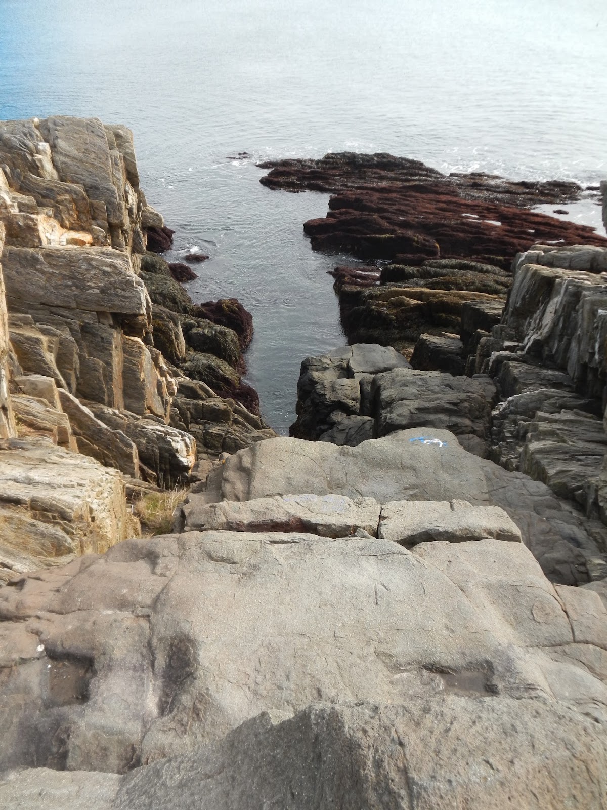
At the far southern end of the trail, you can go cross-country on the "Gully Trail" to access a narrow cleft in the rock that apparently has a "thunder hole" in rough weather (although I don't know anyone who's ever seen it). From the path, look for red blazes -- which are really just red dashes painted on the rocks -- and stay on the trail to avoid trespassing on private property. This takes you to the "Gully", which is really beautiful.
 |
| Nice little cove. |
 |
| The Gully. This is spectacular in a storm I bet! |
To Get There: From US 1 in Brunswick, take the Cooks Corner/Rt 24 exit, and go south on Rt 24 for 14.5 miles, to Washington Street (located on your left, just after Mackerel Cove). On Washington; bear right at the fork in the road and park at the tiny Episcopal Church. Parking is limited; DO NOT park here Sunday mornings and DO NOT park on the street. You will be towed. If you need to, you can park at Mackerel Cove park and walk to Giant Stairs. From the parking lot, walk downhill to the path. You can walk the short loop; proceeding south on the trail takes you to road access at the Macintosh Lot and you can get back to the parking area that way.
Come at low tide, and do not collect organisms unless you have a permit.
Dogs are permitted on leash!


 .
. 


No comments :
Post a Comment